| Home > All By Location regional map > Pittsburgh West > Sixth Street Bridge 1819-1857 | |||
|
|
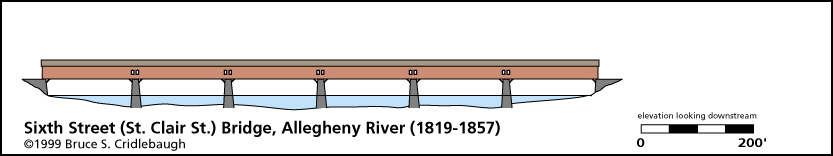
Elevation drawing looking downstream 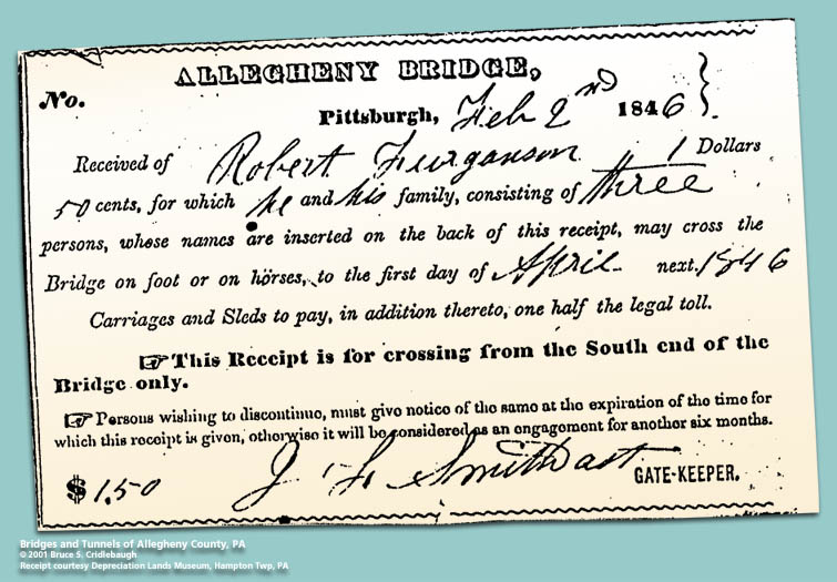
Receipt for passage, 1846 OFFICIAL NAME: Allegheny River Bridge OTHER DESIGNATION: Sixth Street Bridge, St. Clair Street Bridge LOCATION: Pittsburgh USGS 7.5" Topo Quad - UTM Coordinates: Pittsburgh West - Zone 17; 0584 4477 CARRIED: pedestrians and horse-drawn vehicles BETWEEN: -- Federal St [Franklin Rd] on right descending bank of Allegheny River -- Sixth St [St. Clair St] on left descending bank of Allegheny River CROSSED: -- Allegheny River at mile 0.5 TYPE OF CONSTRUCTION / DESIGN: wooden, Burr truss, covered LENGTH OF MAIN SPAN: four spans, 185 ft; one span, 170 ft; one span, 137 ft (HAER) TOTAL LENGTH (including longest elevated ramp): 1,047 ft HEIGHT OF DECK: 38 ft YEAR ERECTED / ENGINEER: 1819, Louis Wernwag; replaced 1857 ADDITIONAL INFO: The first bridge (1819) to cross the Allegheny River and the first of four which would connect Federal St to Sixth St was a Burr arch-truss. This bridge was built as part of the project which included the first span of the Monongahela River - - the first bridge at Smithfield St -- which was completed a year earlier. Both were designed by Louis Wernwag. It was built at a cost of $92,250. (Other sources report $80,000.) The bridge was lighted by gas lamps December 8, 1837. Sixth St was formerly St. Clair St in Pittsburgh; it aligns with Federal St (formerly Franklin Rd which connected to the Venango Path) in the former city of Allegheny (Northside). view page - "Three Sisters" Bridges -- Historic American Engineering Record document FIELD CHECKED: INFO SOURCES: Lorant, "Pittsburgh"; Van Trump "A Trinity of Bridges (HAER)"; Boucher "Pittsburg and her people" Submit info or inquiry - share some facts or ask a question. Introduction -- Nearby Structures Page created: Last modified: 10-Aug-2001 |
View Larger Map 
| |
| copyright: © Bruce S. Cridlebaugh 1999-2008 All Rights Reserved | |||